Maximum temperatures in most districts of the state will be in the 41 to 45 degrees Celsius range for the next four days
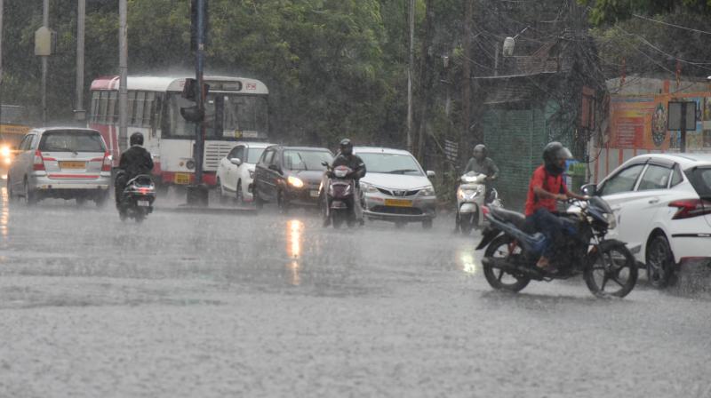
Maximum temperatures in most districts of the state will be in the 41 to 45 degrees Celsius range for the next four days. The forecast for the next 24 hours states that partly cloudy sky, with rain or thunderstorm, is very likely to occur in parts of Hyderabad. (
According to IMD Hyderabad, the city recorded a maximum temperature of 39.7 degrees Celsius on Saturday, which was 0.5 degrees above normal. Nizamabad recorded a maximum temperature of over 42 degrees.
The forecast for the next 24 hours states that partly cloudy sky, with rain or thunderstorm, is very likely to occur in parts of Hyderabad. The maximum and minimum temperatures are likely to be around 41 degree and 28 degrees Celsius, respectively.
According to IMD Hyderabad, the city recorded a maximum temperature of 39.7 degrees Celsius on Saturday, which was 0.5 degrees above normal. Nizamabad recorded a maximum temperature of over 42 degrees
Over the next five days, light to moderate rains or thundershowers are likely to occur at isolated places across Telangana. With extreme humidity, once a few places cross above 41 degrees Celsius, light to moderate rains with thundershowers are expected in the afternoons and late evening hours in some districts, said a scientist from IMD, Hyderabad.
The districts in which temperatures are likely to be between 41 and 45 degrees Celsius for the next four days are Hyderabad, Adilabad, Asifabad, Mancherial, Nizamabad, Kamareddy, Karimnagar, Siddipet, Vikarabad, and Ranga Reddy.
Cyclone off Bay of Bengal
Meanwhile, squally winds reaching 40-50 kmph and gusting to 60 kmph were likely in the coastal districts of Andhra Pradesh on May 10 and 11 under the influence of a cyclone that is being formed in the Bay of Bengal.
There would be light to moderate rainfall when the system moved over the sea along the Andhra Pradesh coast. The government has directed fishermen not to go to sea till further instructions.
According to weathermen from the India Meteorological Department (IMD), the cyclone is likely to move northwestwards till May 10 and reach the west-central and adjoining northwest Bay of Bengal off north coastal Andhra Pradesh and south Odisha coasts.
Thereafter, the system is very likely to recurve north-northwestwards and move towards northwest Bay of Bengal off the Odisha coast. Gale winds reaching 80-90 kmph gusting to 100 kmph were likely to prevail around the cyclone at sea.
****************************************************************
Readers
These are extraordinary times. All of us have to rely on high-impact, trustworthy journalism. And this is especially true of the Indian Diaspora. Members of the Indian community overseas cannot be fed with inaccurate news.
Pravasi Samwad is a venture that has no shareholders. It is the result of an impassioned initiative of a handful of Indian journalists spread around the world. We have taken the small step forward with the pledge to provide news with accuracy, free from political and commercial influence. Our aim is to keep you, our readers, informed about developments at ‘home’ and across the world that affect you.
Please help us to keep our journalism independent and free.
In these difficult times, to run a news website requires finances. While every contribution, big or small, will makes a difference, we request our readers to put us in touch with advertisers worldwide. It will be a great help.
For more information: pravasisamwad00@gmail.com


